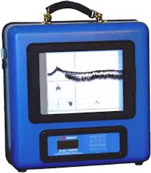
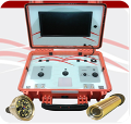
Ground Penetrating Radar (GPR LOZA)

Ground penetrating radar is a geophysical tool for the underground environment inspection. GPR emits a broadband radio frequency signal and records the reflection of the signal from different objects of the soil ground.

The geo-radar consists of three basic elements:

  • Transmitter:  the block of the probing impulses formation with the transferring antenna.
  • Receiver: the block of reflected signals registration with the reception antenna.
  • Control and indication unit.

During the work of a geo-radar, the transmitter (the block of the probing impulses formation) radiates in depth a short impulse -an electromagnetic signal-. This signal extends in the soil ground and in air where experiences various wave processes. The signal, which has reached the ground surface to the reception antenna is received, amplified, digitized, and registered in memory of the geo-radar by the registration block.

Marine depth measuring device (Bathy-500mf Multi Frequency- Survey Echo Sounder)

The Bathy-500MF Survey Echo Sounder provides a high-contrast thermal chart record complete with alphanumeric annotation
of important parameters such as geographic position, depth, speed of sound and offset for draft/tide. Real-time viewing of all
parameters is provided to the user via front panel liquid-crystal display. Position input can be from either a standard C/A GPS
receiver or differential GPS system. Depth data is available to external devices in digital form, via a versatile interface.

Water Quality Measuring Device (Eureka Manta Multiparameter Water Quality Recorder)

Multiparameter sondes for monitoring water quality in fresh, brackish, and marine waters.

Tide Gauge (Valeport Mini Tide)

Tide Recorder, designed for short-term underwater deployments

Underwater Roc Camera (Rov Tech Analog HD Drives Camera)

ROV camera
 allows users to get eyes underwater to perform a wide variety of tasks including inspection, retrieval, and observation among countless other
Marine Habitat Survey Instrument (Aquatic Habitat Echosounder)
  • Map submerged aquatic vegetation (SAV)
  • Map eelgrass and other habitat areas
  • Monitor invasive aquatic weeds
  • Delineate areas of sand, mud, rock
  • Generate contour profiles
  • Shallow water mapping

Benthic Surveying Device (Seafloor HyDrone-RCV Survey)

Autonomous & remote-controlled surveying device to be used in Work environments include mines, sewage treatment plants, contaminated lakes, harbors, and rivers.